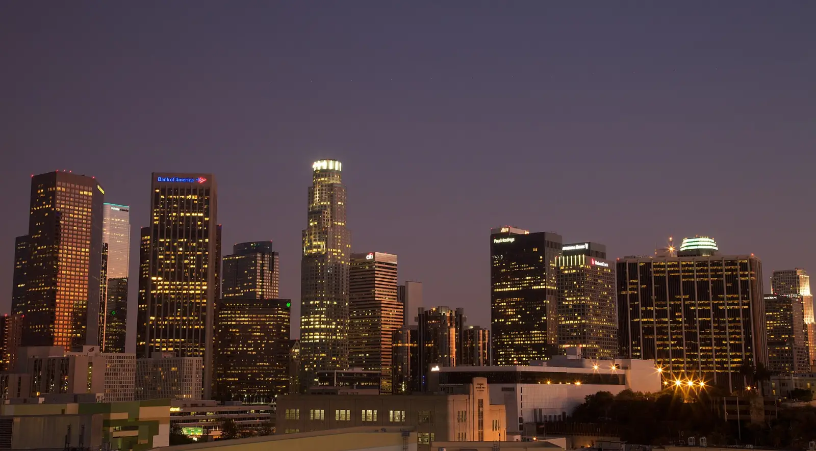
Los Angeles clears out on a schedule, and last call sets it. Alcohol service stops at 2 a.m. across California, so Hollywood, Downtown, Koreatown and the Valley strip malls put their crowds onto the sidewalk within a few minutes of each other. After that the freeways run at the speed they are signed for. These are the roads worth being on while it lasts. They sit with the rest of Los Angeles after dark.
- The empty window
- Roughly 2 a.m. until the first commuters, somewhere around 4 or 5.
- Arroyo Seco Parkway
- Opened December 1940 and engineered for a 45 mph cruise. 8.2 miles from downtown to Pasadena through four tunnels, and the first freeway built in the western United States.
- The 405 in the Sepulveda Pass
- Around 280,000 vehicles a day through the pass on the current Caltrans counts, on the road the Federal Highway Administration once called the busiest interstate in any American city.
- Nightly work in the pass
- Caltrans is repaving 10.2 miles of the 405 between Van Nuys and Westwood, a $143.7 million job it schedules into winter 2027. Weeknight lane closures are posted at about 9 p.m. to 6 a.m., many of them held to 11 p.m. to 5 a.m., and the occasional full closure falls between midnight and 5 a.m.
- Judge Harry Pregerson Interchange
- Five levels, opened 1993, about 130 feet at its highest point.
- The Glendale Freeway
- Built from 1959. Caltrans dates the rescinding of the full build-out plan to 1962, after local community opposition. The state did not formally give up the adopted route to the 101 until the mid-1970s.
- Angeles Crest Highway
- 66 miles from La Cañada Flintridge to the Pearblossom Highway, with the summit at Dawson Saddle around 7,900 feet. Twenty degrees or more colder than the valley by day, and a good deal less than that after dark.
- The streetlight retrofit
- More than 140,000 fixtures replaced between 2009 and 2013, much of it cool 4000 Kelvin LED in place of amber sodium.
- The Palisades Fire
- Began 7 January 2025. Twelve people died. Caltrans closed 8.5 miles of Pacific Coast Highway between Chautauqua Boulevard and Carbon Beach Terrace, and reopened the road on 23 May 2025 under a 25 mph limit.
When the city empties
Metro Rail runs its last trains around midnight and does not run overnight. The subway keeps the same hours every night of the week, weekends included, so there is no later train home on a Friday. The OWL bus network covers the gap at roughly hourly headways, and what is moving on a boulevard at that hour is a lit bus with almost nobody in it.
Caltrans has been out for hours by the time the bars close. The night closure windows in the list above start around 9 or 10 p.m., so the orange arrow boards are already standing on shoulders across the basin while the crowds are still inside.
Rail comes back around 4 a.m. By then the freeways are refilling from the east, because the long-distance commute out of the Inland Empire leaves in full dark. Headlights build westbound on the 10 and the 60 with the sky unchanged. That gap is what this page is about.
The 110 through the tunnels
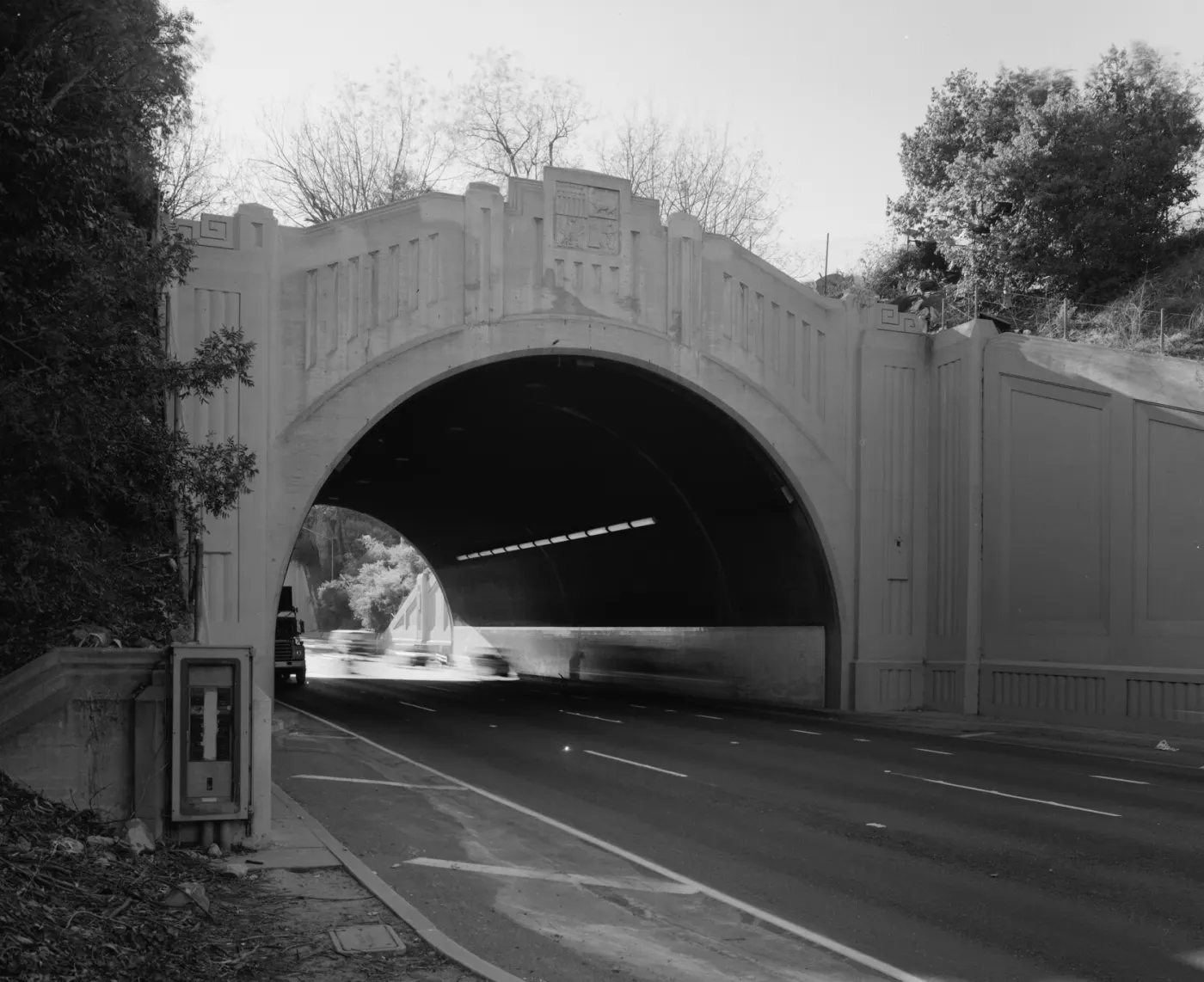
The Arroyo Seco Parkway was built for the traffic of its own decade and has never been widened for anyone else's. North of the Los Angeles River almost none of it has been rebuilt. On-ramps begin at a stop sign on the shoulder of a live freeway with no acceleration lane, so merging means sitting there until a gap comes and then using all of the engine, which is a maneuver no road built since would ask for. Exit ramps carry advisory speeds as low as 5 mph.
Four tunnels run through the Elysian hills, and they carry the northbound lanes only, so the tunnel run is the Pasadena-bound one. The portals are Art Deco cast concrete with the city seal at the crown of the arch and sunburst panels formed into the face beside it. White paint on the concrete picks up headlights before you reach it. The lanes are narrow enough that a modern pickup fills one edge to edge. Sycamores and alders lean over the pavement from the arroyo bank, and leaf litter piles against the curb where a shoulder would be. A few original-era signs survive along the route, small button-copy panels on sign structures of the same age.
The pass at two in the morning
The 405 crosses the Santa Monica Mountains through the Sepulveda Pass, and the Federal Highway Administration once called this stretch the busiest interstate in any American city. The road climbs and falls across the pass instead of running level. From the top the brake lights ahead are a red river bending downhill, and the Getty's travertine sits pale on the ridge above them, holding sunset light for a while after the freeway below has gone into shadow. Noise carries up into the canyons on both sides. From driveways in Bel-Air and Sherman Oaks it arrives as a flat hiss with no separate cars in it.
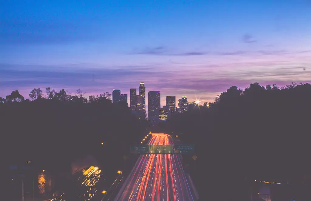
The same pass after last call runs five open lanes in each direction with almost nothing on them. The only slow thing is a Caltrans crew behind orange arrow boards, with cone trucks and portable light towers on the shoulder and the generators running. Caltrans does most of its maintenance here overnight, so on many nights the empty pass and the coned-off pass are the same road. The pavement rehabilitation project publishes which nights those are.
Five levels at the Pregerson
The Judge Harry Pregerson Interchange is where the 105 meets the 110 in South Los Angeles. It stacks concrete decks on single columns, with ramps crossing over ramps and sky between them. What is unusual about it is the mix. Car ramps share the structure with Metro C Line light rail, the Harbor Transitway busway and the ExpressLanes connectors, and the Harbor Freeway station is elevated inside the interchange itself, so people wait for a train with freeway on every side of them and underneath. That is a normal commute for a lot of people.
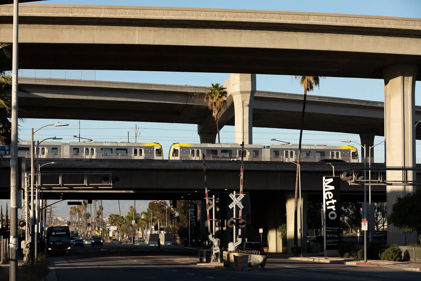
At night the deck lighting picks out the undersides of the ramps and the structure reads as ribbons rather than as a road. The 105 runs dead straight east to west toward LAX. From the top ramps the planes on approach are lined up in the west.
The freeway that stops
State Route 2, the Glendale Freeway, was meant to keep going. The plan took it through Silver Lake and Echo Park to the Hollywood Freeway, and an earlier version carried it on west as the Beverly Hills Freeway, through Hollywood and Beverly Hills to the San Diego Freeway. Neither extension was built. What exists now is a freeway that runs at full width until it does not, and then puts its traffic onto a surface street.
Southbound it drops to two lanes where it spills onto Glendale Boulevard, which is signalized and lined with parked cars. The last overpass has no road on the far side of it. At night the freeway lighting ends and the next thing over the windshield is a streetlight and a stop sign.
Out of the streetlights
Angeles Crest Highway leaves La Cañada Flintridge and climbs into the Angeles National Forest. There is no street lighting once the last houses are behind you. The Forest Service tells visitors that cell coverage inside the forest is very limited to non-existent and that nobody should count on a phone in an emergency. The air turns to dry pine instead of coastal salt as the road gains height, and the temperature falls with it.
The stretch between Islip Saddle and Vincent Gap is closed and unplowed most winters, from the first snow until May or June, so the through route to the desert side of the range shuts for part of every year. On a weeknight the road is deer and rockfall. From the pullouts above La Cañada the basin lies below as an orange and white sheet. What sits between the road and the city on some nights has a page of its own. Mulholland, the other ridge road worth driving after dark, has one as well.
The color of the light
The streetlights over Los Angeles are white now. When the city finished converting them in 2013 it was the largest LED streetlight retrofit anyone had attempted, and Chicago has since converted more. Red cars go brown under the new lamps, and skin reads wrong.
Sodium went everywhere. The old lamps threw light in every direction, onto the pavement and onto the front of the houses at the same time, and a sodium street read as one lit surface. LED optics aim, and stop. The road is lit and the edges fall away, so the same street now reads as a row of separate lamps rather than a continuous wash.
The City of Los Angeles puts its own system at 98 percent LED, so the amber still burning is scattered leftovers and privately lit parking lots. The retrofit put more light upward as well. Lumen for lumen, 4000 Kelvin LED throws roughly 2.7 times the skyglow of the sodium it replaced, and satellite radiance over the city read higher after the conversion than before it. What the light does in the hour before any of it switches on has a separate page.
Wet asphalt is seasonal here. Nearly all the rain falls between November and April, and the first storm after a long dry spell lifts months of oil off the road, which makes the most reflective night of the year the worst one to be out in. Everyone drives badly in an inch of water. The storm drains that are dry ditches for most of the year run full and loud. In July the road is dry and there is nothing to reflect.
Where the fire came through
Pacific Coast Highway reopened through the Palisades burn scar in May 2025. It is a working construction zone, and it is on this page only because a coast route at night goes through it.
Twelve people died in the Palisades Fire. The stretch between Temescal Canyon Road and Carbon Beach Terrace is where a lot of the houses it destroyed stood, and what is on the inland side now is empty foundation pads and construction trailers in driveways that used to belong to houses.
The ocean on the other side is unchanged. Temporary signals and flaggers control the traffic. Bare hillsides above the pavement put mud onto it after rain. Drive it at the posted speed and keep going. Traffic there is mostly contractors' trucks by day and close to nothing after dark.
What it costs you
Street sweeping in Los Angeles runs in daytime windows. Almost every posted route the city publishes starts between 8 a.m. and 1 p.m. and holds the curb for two hours, with parking enforcement following the sweeper, so a car left in a posted space collects a ticket in the morning instead of a warning. Read the sign before leaving the car.
Residential streets are not a scenic route. People are asleep behind those windows. LAPD's Air Support Division keeps helicopters up roughly twenty hours a day, so a searchlight holding on one block is an ordinary night in this city. The last cost is the plain one. A tired driver is a hazard, and nothing on this page is worth being one for.
Checking before you go
Caltrans publishes lane and ramp closures on QuickMap, which covers the state highways in near real time, including the 405 through the pass and Pacific Coast Highway. City streets are posted separately, on the LADOT news page. Check both. A state route and a city street close for different reasons and are published in different places.
What to put on
Nothing has been released yet, and when there is something, the first track will have its page and every place to hear it will be on one page. Put it on after last call.